How do I store geological data?
There are multiple ways to store geologic data in Enviro Data.
You can assign geology and lithology to each physical sample in the Samples table. This makes it easy to tie the geology to field and lab data.
You can also select a geologic unit for each station in the Stations table. This is generally used for the formation at the bottom of the hole for soil and similar borings, or the geologic unit of the screened interval for water wells.
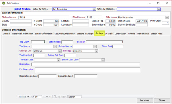
Finally, in the Stations table you can store formation “tops” by location and independent from the samples. This probably better represents the actual site geology and allows you to enter the geologic column encountered at a Station location by depths. This could be (and often is) different from the geology of the samples and may be referred to as the site stratigraphy. You can do this in the form below from the EDITOR; click on Stations and then on the Geology tab as shown below.